This new feature class had many different features of the campus like buildings, sidewalks, utility poles and other important data. These features can delineated based on the 'layer' they were on in the CAD file. This information is brought over to the GIS in a field called 'layer'.
This class, we will use the georeferenced data that we imported from CAD to a single feature class to parse out into individual features classes.
HOW?
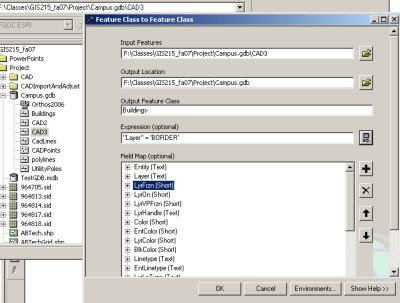
Utilize ArcCatalog to EXPORT layers. During the export using the query tool to select a subset of features to be exported to the new feature class. This will allow you to segregate features from individual CAD layer and export them to feature classes.
You should end up with individual feature classes in your geodatabase for buildings, sidewalks, utility poles, etc...
See graphic below for an example of how the dialog box should look for exporting the features from the buildings layer to a new Buildings feature class in the same geodatabase.


No comments:
Post a Comment